Derivations
To use certain features, you first need to prepare Conveyal-specific data by deriving them from your Data Sources. Available derivations include:
- Polygon Shapefile → Aggregation Area
Aggregation Areas
Aggregation areas are used to summarize regional analysis results. To create an aggregation area, use the Data Sources panel to upload and process a polygon shapefile. Options to create aggregation areas from other spatial data source formats (e.g. geopackage and GeoJSON files) are coming soon.
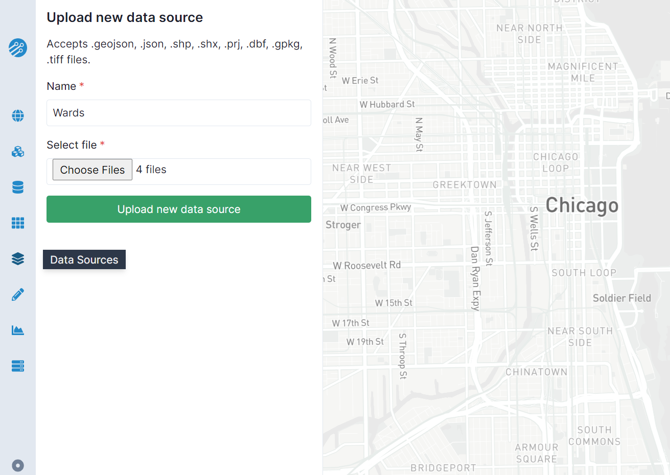
To upload a shapefile in the Data Sources panel, click Upload new data source.
Then, provide a name and select all components: .shp, .dbf, .shx, and .prj files. To derive an aggregation area from a shapefile, it must fit within a bounding box smaller than 975,000 sq. km, must not have any feature with area exceeding 2 square degrees, and should preferably use unprojected WGS84 coordinates.


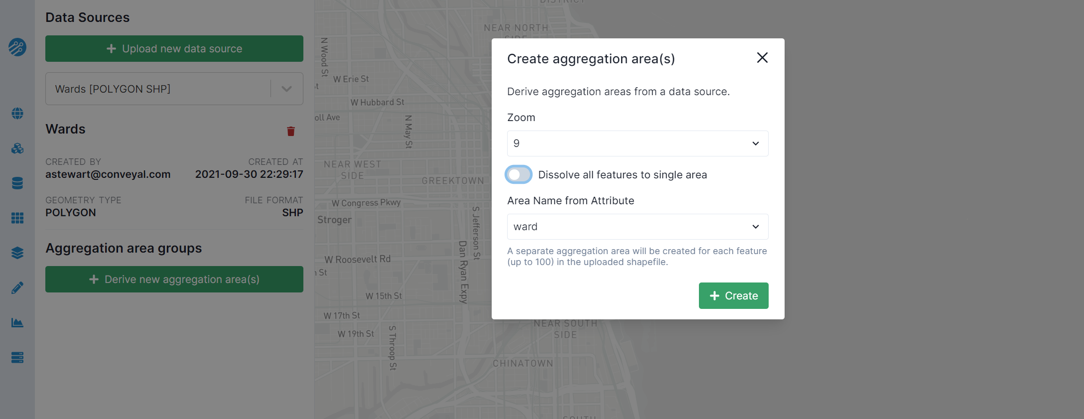
To convert an uploaded shapefile to an aggregation area, click Derive new aggregation area(s).
In the pop-up "Create aggregation area(s)" form, the Zoom can be left at the default value or set to the zoom level of the regional analysis with which you want to use the aggregation area. If you leave Dissolve all features to single area toggled on, all features of the selected polygon data source will be merged to a single aggregation area. If you switch this setting off, each feature of the data source will be a separate aggregation area, and you will need to select an attribute to name them. For example, if you want to report a project's change in accessibility for each city council district, and you have a shapefile of with each district's name in a column "CD_Id," you would toggle this setting off and select "CD_Id" as the attribute.


Once you have successfully created an aggregation area, you can select it when viewing the results of a regional analysis.